Catalog Archive
Auction 128, Lot 529
"Plan des Villes de Londres et de Westminster et de leurs Faubourgs avec le Bourg de Southwark", Fer, Nicolas de
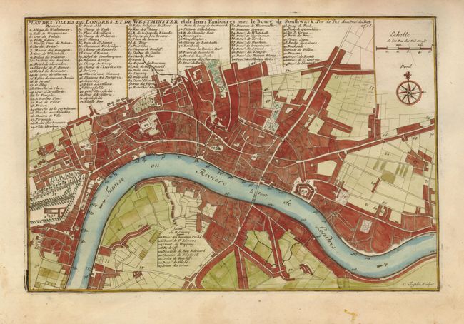
Subject: England, London
Period: 1705 (dated)
Publication:
Color: Hand Color
Size:
13.3 x 9.8 inches
33.8 x 24.9 cm
Download High Resolution Image
(or just click on image to launch the Zoom viewer)
(or just click on image to launch the Zoom viewer)