Subject: England
Period: 1675 (circa)
Publication: Britannia
Color: Hand Color
Size:
17.3 x 13 inches
43.9 x 33 cm
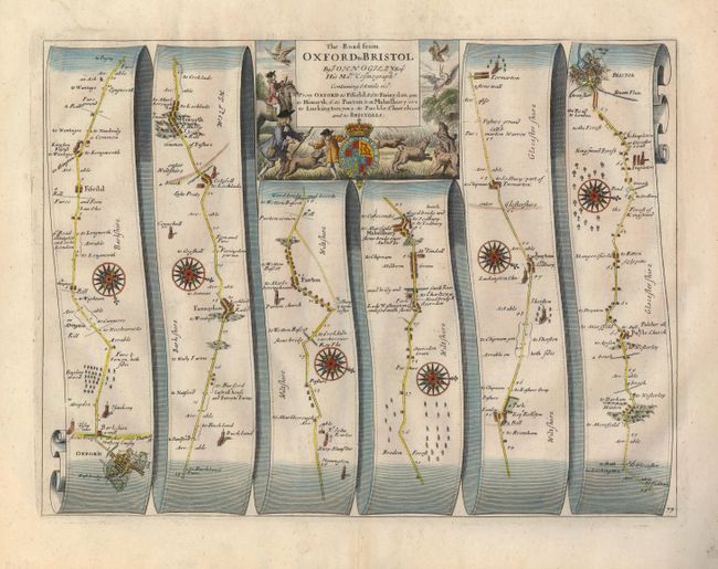
John Ogilby's 'Britannia' was published between 1675 and 1698. It is a landmark in the mapping of England and Wales. Its unique format constituted the first national road-atlas of any country in Western Europe. It was composed of maps of seventy-three major roads and cross-roads, presented in a continuous strip-form, on a uniform scale of one inch to a mile. Each beautiful map includes wonderful detail of the countryside with each strip containing a large compass rose to indicate changes in direction.
This superb map on ribbon panels begins with a town plan of Oxford and travels in an easterly direction through Malmesbury and terminates in Bristol. Each of the six panels is oriented with a bold compass rose with details of the villages, churches, bridges, castles, parks, forests, etc. The large strapwork title cartouche has a fine hunting scene and incorporates the royal coat of arms.
References:
Condition: A
Nice impression printed on sturdy paper with wide original margins. There is a short, professionally repaired tear in the top margin, well away from the map and a small weakness at center with tissue reinforcement on verso.