Subject: World
Period: 1752 (dated)
Publication: Histoire de L’Academie Royale des Sciences
Color: Black & White
Size:
12.5 x 12.3 inches
31.8 x 31.2 cm
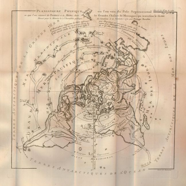
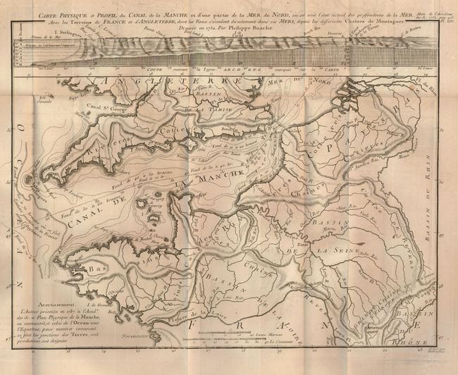
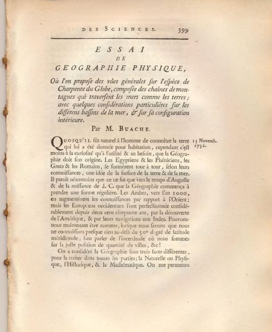
In 1752, Philippe Buache, geographer to the Royal Academy of Sciences, presented an important paper to the academy proposing a radical new theory of physical geography. This paper, Essai de Geographie Physique…, suggested that the earth's structure was made up of major mountain ranges connected beneath the oceans that divide immense river basins, which then open into the oceans. The article was accompanied by two maps that are significant in the history of cartography. The first map presents the world on a polar projection and illustrates Buache's theory, which was the origin of the modern watershed drainage basin concept. This map shows a huge Sea of the West and partial Northwest Passage in North America. The second map portrays the connection between France and England with a profile at top illustrating the depths in the English Channel using isobaths. This is the first map to use that method of illustrating an ocean seabed and also represents one of the earliest uses of contours for displaying landforms. This lot includes the original essay, disbound, consisting of 17 pages of French text (8 x 10.3") and the two folding maps: Planisphere Physique ou l'on voit du Pole Septentrional… (12.5 x 12.3"), and Carte Physique et Profil du Canal de la Manche et d'une Partie de la Mer du Nord (12.3 x 9.5").
References: Potter, p. 178-79; Robinson, pp. 87-90.
Condition: A+
Maps with some faint offsetting, overall fine with sharp impressions.