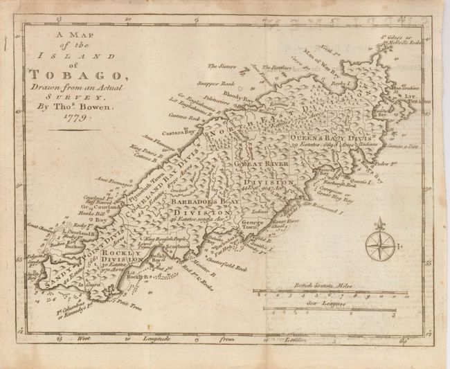
Subject: Lesser Antilles, Tobago
Period: 1779 (dated)
Publication: Gentleman's Magazine
Color: Black & White
Size:
9.5 x 7.5 inches
24.1 x 19.1 cm
An attractive, small map fully engraved with much detail on the island. The island is partitioned into seven divisions, each identifying the number of acres and estates. Near Rocky Bay is a notation about the location of King Roufsels People, referring to a small group of Amerindians, the remaining indigenous people of Tobago. Soundings and shoals are marked in the harbors, and the map is oriented with a nice compass rose. Two distance scales at lower right.
References: Jolly GENT-262; Sellers & Van Ee #2112.
Condition: B+
Folding, as issued, with full margins. A little faint offsetting from magazine text at right and in a narrow band along left neatline, light stain line along upper margin.