Catalog Archive
Auction 128, Lot 439

"Carte de l'Isle de St. Domingue une des Grandes Antilles, Colonie Francoise et Espangnole", Bonne, Rigobert
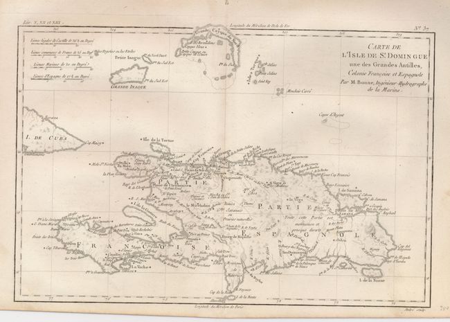
Subject: Hispaniola

Period: 1780 (circa)

Publication: Atlas de Toutes les Parties Connues du Globe Terrestre

Color: Black & White

Size:
12.5 x 8.5 inches
31.8 x 21.6 cm
Download High Resolution Image
(or just click on image to launch the Zoom viewer)

Engraved chart of the entire island that is delicately engraved to show watershed, topography, coastal features and the settlements. This map also includes some of the Turks and Caicos Islands, as well as the tip of Cuba. Four distance scales at upper left.

References:

Condition: A

On thick hand laid paper with delicate impression and original margins. One worm hole in blank upper margin along centerfold, well away from map image.

Estimate: $140 - $180

Unsold

Closed on 5/20/2009

Archived