Subject: Gulf of Mexico and Caribbean
Period: 1740 (circa)
Publication:
Color: Hand Color
Size:
18.5 x 22 inches
47 x 55.9 cm
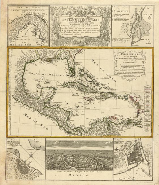
This informative and very graphic folio sheet has a large map of the region, titled "Carte des Isles de l'Amerique et Deplusieurs Pays de Terre Ferme," attributed to D'Anville (1731). It covers the Gulf of Mexico, Central America and all of the Caribbean islands. It is nicely detailed with a key to show European possessions and a beautifully engraved title cartouche. Above the main map is the large, decorative title cartouche, flanked by insets of the isthmus of Panama and a plan of St. Augustine in Florida. Below the map is a large view of Mexico City, flanked by plans of Vera Cruz and San Domingo. A very handsome sheet, absolutely filled with information on the West Indies.
References:
Condition: A
Map image is very good with original color and fine impression and full margins. Some light staining or mildew in upper and lower left corners restricted to margins.