Subject: Mexico, Caribbean
Period: 1579 (published)
Publication: Theatrum Orbis Terrarum
Color: Hand Color
Size:
19.5 x 14 inches
49.5 x 35.6 cm
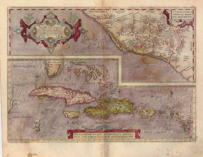
Two great early maps of important regions in the New World. The first covers the region of western Mexico around Culiacan and the Spanish settlement of Villa S. Michael's, the region noted for its silver mines. Below, the map of the Greater Antilles presents detail in southern Florida and the Caribbean that is quite remarkable for the period. The map includes an interesting error in that the Tropic of Capricorn is shown where the Tropic of Cancer should be. Ortelius based the maps on a variety of sources including Mercator’s world map (1569) and other maps by Gutters and Alone De Santa Cruz. Three strapwork cartouches and sailing ships decorate the map. Latin text on verso.
References: Van den Broecke #14.
Condition: B
Very good original hand coloring, dark, early impression and wide margins on supple, sound paper. A damp stain involves about a third of the map. There is a small hole in the lower margin at centerfold, well away from map image. The map is quite handsome even with the light stain and would be a fine example after a simple cleaning by a professional.