Subject: United States & Mexico, Texas
Period: 1842 (dated)
Publication:
Color: Hand Color
Size:
15.5 x 12 inches
39.4 x 30.5 cm
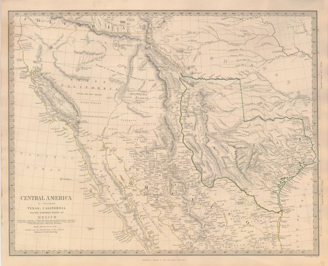
This excellent map covers the southwestern United States just a few years before Mexico lost the region in the Mexican/American War. Texas is shown as an Independent Republic with its panhandle extending well north up to Spanish Peaks. Excellent detail throughout Texas shows many towns and villages, roads and trails, topography, and watershed. In Texas the map locates Austin, Houston, S. Antonio de Bexar, Franklin, Waco Village, Fort Parker Field, the "Supposed Petrified Forest," and the huge range of the Comanche Indians. All of the Southwest and California are here noted as "Generally called Upper California". Large swamps and lakes in the Great Basin drain through a complex R. Buenaventura system. Another interesting notation; Supposed residence of the Aztecs in 12th century (Humboldt ) in the Moquis (Hopi) region of present-day Arizona. Published by Chapman and Hall.
References: Wheat [TMW] #460.
Condition: A
Handsome sheet with good impression and original hand coloring in outline. Lovely overall ivory age toning to paper. A little marginal soiling and a very short tear in left margin.