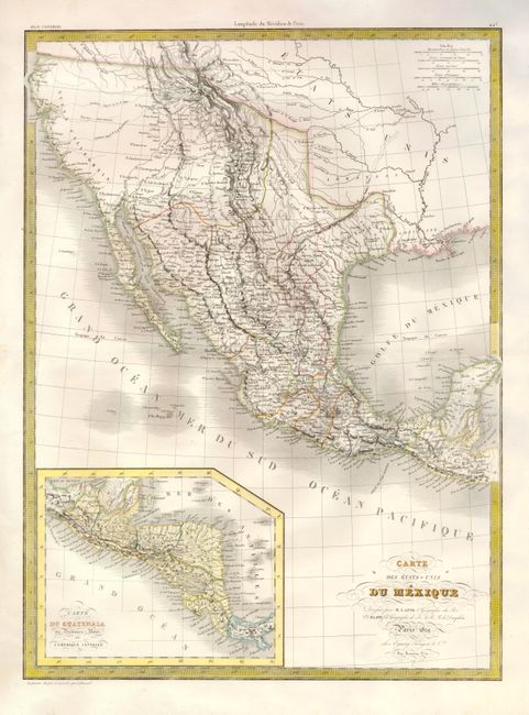
Subject: United States & Mexico
Period: 1829 (dated)
Publication:
Color: Hand Color
Size:
15.5 x 21.5 inches
39.4 x 54.6 cm
An attractive map that shows the Southwestern United States through Mexico to the Yucatan and an inset of Central America. This map shows Texas as the province of Potosi within Mexico. The Rocky Mountains are well delineated by hachure and incorporate information from Humboldt, Pike, and Long. The American West reflects cartography that predates Fremont and Smith’s explorations, including two Salt Lakes and the mythical rivers that connect them to the Pacific. The Lapie map was probably based upon Brue’s earlier map of the same area, and it contains similar roads, settlements, and topography.
References:
Condition: A
Faint foxing in the wide margins.