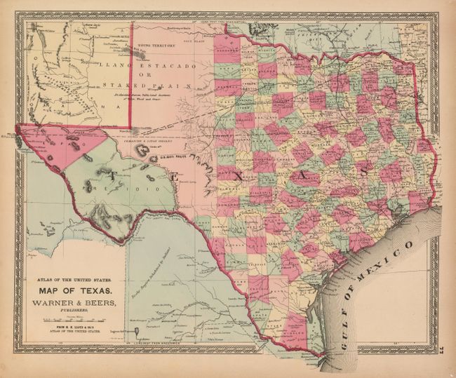
Subject: Texas
Period: 1872 (circa)
Publication: Atlas of the United States
Color: Hand Color
Size:
16.5 x 14 inches
41.9 x 35.6 cm
This is a spectacular example which shows the existing network of wagon roads, the U.S. Mail Route, existing and proposed railways, watershed, and much more. Hand colored by county with fine detail throughout. Each county seat is located and named. Each county contains their date of incorporation, an uncommon feature for maps of this period. West Texas is made up of the huge Young Territory and the counties of El Paso and Presidio. The panhandle and part of New Mexico is the Llano Estacado or Staked Plain, which bears the notation "An elevated Barren Table Land destitute of Water, Wood and Grass." The map includes a portion of New Mexico and Indian Territory. Published by H.H. Lloyd & Co., and surrounded by a decorative period border.
References:
Condition: A+
This example has the finest impression and coloring we've seen from this series of maps. Margins with some edge age toning, but still fine.