Subject: Texas
Period: 1860 (dated)
Publication: New General Atlas
Color: Hand Color
Size:
13.5 x 10.7 inches
34.3 x 27.2 cm
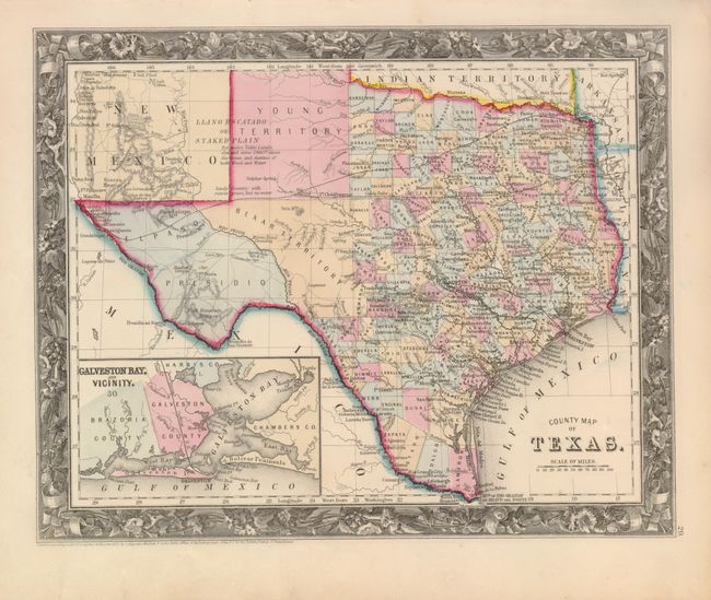
One of the most attractive maps produced of the state of Texas. Large inset map of Galveston Bay and Vicinity is on a closer scale. West Texas is made up of the huge Young Territory, Bexar Territory, El Paso and Presidio Counties. The panhandle is the Llano Estacado or Staked Plain which bears the notation the region is "destitute of both wood and water." Trails and roads are shown and limited railroads extend only into Austin. Numerous dashed lines indicate proposed railroads. Surrounded by the finely engraved border found on the first few issues of this map. Based on county development this map was published circa 1862-64.
References:
Condition: A
Map image is fine with beautiful, original color, crisp impression and full margins. A little very light marginal toning or soiling mostly in lower margin.