Subject: South Carolina
Period: 1891 (dated)
Publication: Bulletin of the United States Fish Commission, Vol. X for 1890
Color: Printed Color
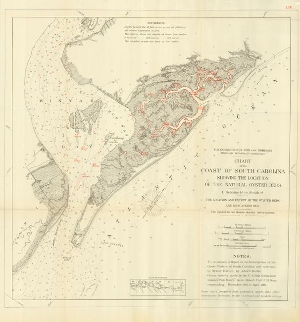
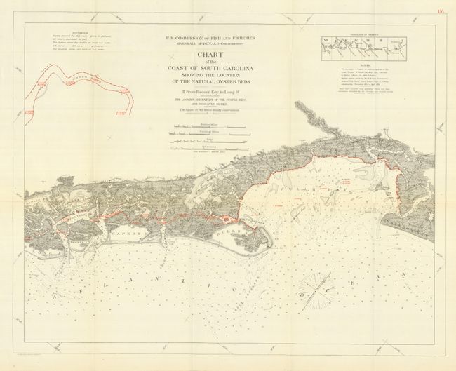
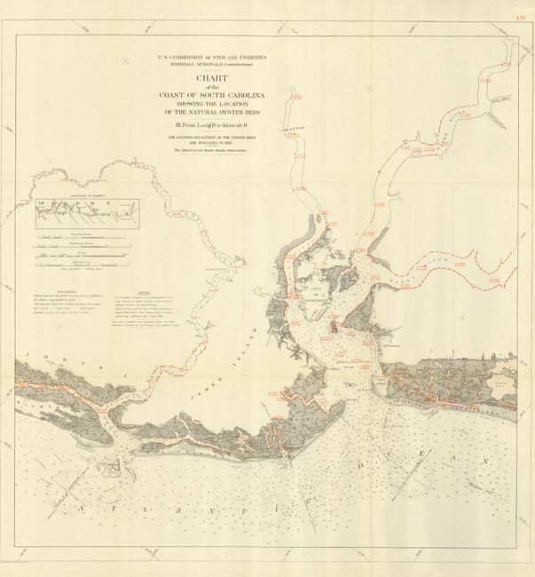
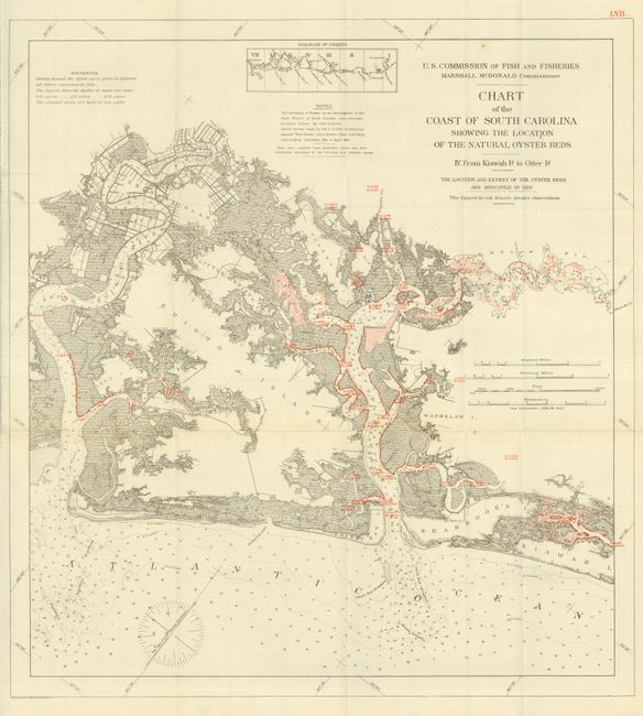
These charts describe the extent of oyster beds as surveyed by the Fish Commission steamer "Fish Hawk" from December 1890 to April 1891. Each base chart is from the U.S. Coast and Geodetic survey with the addition of red overprinting to show the areas surveyed. Adjacent text also in red gives the water density measurements at the bottom and on the surface. This set illustrates much of the middle coast of South Carolina, including some of South Carolina’s most expensive real estate (Charleston, Kiawah Island, Edisto Island, etc.). The shading shows areas exposed at low tide and the 6 ft., 12 ft. and 18 ft. depth curves are shown. Each lithograph shares the full title as given in the first above. The sizes are: 1) 26 x 27"; 2) 25.5 x 20.5"; 3) 25.3 x 26"; and 4) 21 x 23".
The full set includes three more maps which cover the area further south from St. Helena Sound to Savannah. By the 1870's, many of the country's oyster fields were becoming severely depleted, which led to oyster management efforts in the form of laws and regulations. This informative set of thematic charts is from one of the reports documenting that effort.
References:
Condition: A+
Beautiful set, folding as issued. The map III has a few tiny fold intersection splits, still the set is fine.