Subject: Oklahoma
Period: 1881-94 (published)
Publication:
Color: Hand Color
Size:
14 x 11 inches
35.6 x 27.9 cm
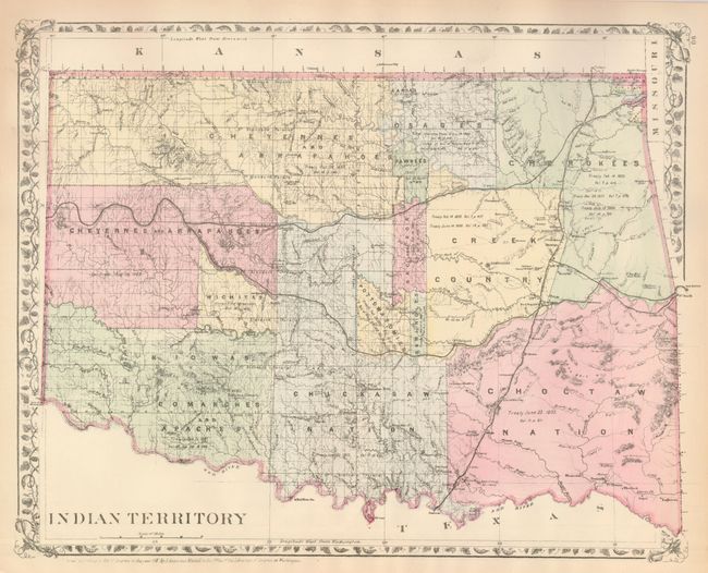
The former is by S.A. Mitchell from his General Atlas of 1881, published in Philadelphia. The distinctive grapevine border is largely sacrificed to accommodate the map. Indian Territory is divided among the various tribes including the nations of Cheyenne, Arapahoe, Comanche, Apache, Kiowas, Chickasaw, Creek, Pottowatomie, Chocktaw, Fox, Osage and Pawnee Indians. Crammed with detail, it shows railroads, waterways and settlements. Colorado map is on verso -- with complete border. Typical of these later Mitchell issues the color and impression are weaker than seen on the earlier maps. (A)
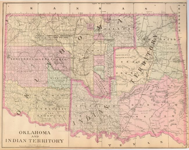
The second map is by A.L. Smith, published circa 1894. The map presents an interesting historical comparison to the above map. Oklahoma emerges in the western portion, leaving Indian Territory in the exact configuration of the State of Sequoyah as it was organized by the Native Americans in 1905. Very close margins with trim affecting neatline at upper right. Good impression and original color. (B)
References:
Condition:
See individual descriptions.