Subject: Massachusetts, Cape Cod
Period: 1892 (dated)
Publication:
Color: Black & White
Size:
38.8 x 30.5 inches
98.6 x 77.5 cm
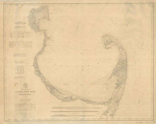
This exceptional sailing chart shows extraordinary detail for the entire Cape Cod Bay from Plymouth and Buxbury Bay in the north to the Provincetown Harbor and Race Point. The fine detail includes individual buildings, bottom conditions, hazards to navigation, and hundreds of sounds. Locates towns and villages including Provincetown, Rock Harbor, Brewster, Barnstable, Sandwich and many more. A large number of lighthouses are shown, including Sandy Neck and the Cape Cod light on the Atlantic side. Notations at left relate to sailing, tides, etc. The map was first drawn in 1872, this is the updated 1892 edition. This example was separately issued unfolded and mounted on original linen.
References:
Condition: B+
A couple small spots or smudges on map, some edges a little rough but overall very good. Original linen is fine.