Subject: Massachusetts, Newburyport
Period: 1891 (dated)
Publication: Official Topographical Atlas of Massachusetts
Color: Printed Color
Size:
26 x 17.5 inches
66 x 44.5 cm
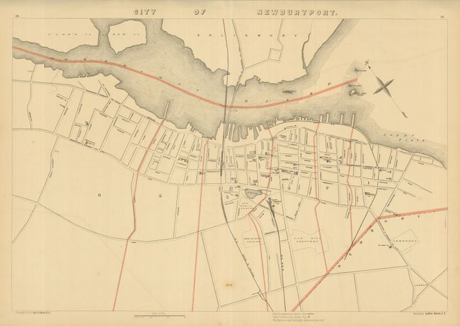
This uncommon plan details the waterfront along the Merrimac River with all streets named. The first two blocks back from the river support the majority of development at the time of this map, but further out is the Mall, Court Headquarters, and the railroad terminal. The map extends to North Atkinson in the west and to Union Street in the northeast along the river. The area is served by the Boston & Maine, Newburyport & Amesbury St., and the Black Rock & Salsbury St. Railways. On a scale of 500 feet per inch with wards identified by number and boundaries colored. Revised by Luther Dame, C.E.
References:
Condition: B+
Very nice example less one faint offsetting line and a spot at lower centerfold.