Subject: Massachusetts, Nantucket
Period: 1787 (published)
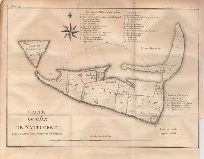
Publication: Lettres d'un Cultivateur Ameriquain
Color: Black & White
Size:
10.8 x 8 inches
27.4 x 20.3 cm
This scarce and finely engraved chart of the island has compass rose above and distance scale below. The extensive list of important buildings and geographical features keys thirty-two items to the map. Locates coastal features, Prairies de New Town, the various districts and villages. Tuckemuck Island is at left. Both islands are inaccurately depicted in this early chart. Engraved by P.F. Tardieu. At upper left is "T. II. P. 99."
References: Phillips, P.L. (Maps) p.457; Streeter (Sale) 711.
Condition: B+
A very nice example with a strong, early impression on thick hand laid paper with large text watermark and original margins. No flaws in image except a slight bit of light foxing.