Subject: Hawaii
Period: 1904 (dated)
Publication:
Color: Printed Color
Size:
33 x 22 inches
83.8 x 55.9 cm
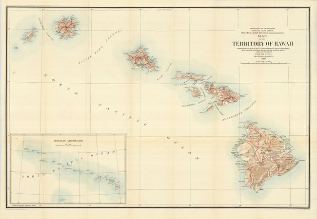
This is a large, colorful map of the Hawaiian Islands that was made shortly after annexation. At this early stage of development there is little settlement shown outside of Oahu. The Mauna Loa volcano is shown with its lava flows. The chart was "compiled from data on file in the U.S. Coast and Geodetic Survey: Hydrographic Office: Hawaiian Government Surveys, and other authentic sources under the direction of Frank Bond Chief of Drafting Division." Published under the direction of the commissioner William A. Richards. Large inset (12.5 x 7.5"), compiled by I.P. Berthrong, gives a wider view of the entire archipelago, extending beyond Midway Island. Good detail on a scale of 1 inch = 12 miles. A beautiful, flawless example.
References:
Condition: A+
Folding as issued with fine color and full margins.