Subject: Hawaii
Period: 1902 (dated)
Publication:
Color: Printed Color
Size:
33 x 27 inches
83.8 x 68.6 cm
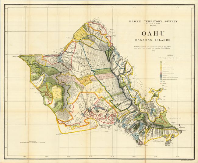
A brilliantly colored and detailed map of Oahu with much information on pineapple and sugar plantations, homesteads, public lands, Crown lands and public buildings. The areas of Diamond Head, Koko Head and Kailua Bay are described, as well as the Cocoa-Nut Grove on Maunaloa Bay, complete with tiny coconut trees. Hawaii's monarchy was overthrown in 1893, and this map was prepared for the Governor's Annual Report of 1906. The governor at this time was George R. Carter. Compiled by John M. Donn "from all available data in the office and also from private surveys."
References:
Condition: B+
Folding, as issued with beautiful, strong color and full margins. A nice example that displays well, but with a couple short fold splits, well closed on verso.