Subject: California
Period: 1855 (dated)
Publication: Railroad Surveys Vol. IV
Color: Hand Color
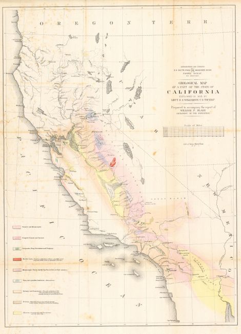
1) A majority of this map (16 x 22.2") covering the entire state of California is hand colored to reflect geological knowledge and coded in accordance with a legend at the left. The legend identifies nine geological types as mapped by Lieut. R.S. Williamson of the Topographical Engineers. There are interesting details throughout, and especially along the American River. Shows a huge Mono Lake, but Lake Tahoe is not shown; rather, in its place is a small lake named Lake Bonpland. In Southern California, Los Angeles, San Gabriel, San Pedro, and more are located. Interestingly, the water between San Pedro (Long Beach) and San Diego is called "Earthquake Bay." Prepared to accompany the report of William P. Blake, Geologist of the Expedition. Lithographed by Sarony, Major & Knapp of New York. Scattered foxing mostly at left and along fold at right. Short tear at binding trim, closed on verso with archival paper tape.
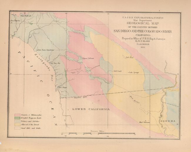
2) This map (9.3 x 6.8") defines five geological types named in the legend via hand coloring. Showing the region along the border with Mexico, the map locates San Diego, San Luis Rey, San Juan Capistrano, Los Angeles, San Gabriel, and Agua Caliente. The map also names a Salt Pond, Salt Creek, Soda Springs and a Mud Volcano in Mexico. Margins toned with one chip well away from map.
References: Marcou & Marcou #678.
Condition:
See individual descriptions.