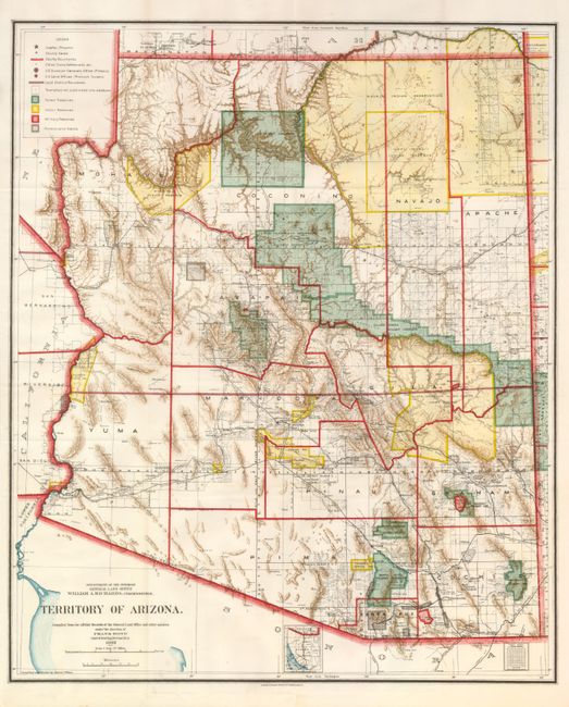
Subject: Arizona
Period: 1903 (dated)
Publication: Department of the Interior
Color: Printed Color
Size:
17 x 20.5 inches
43.2 x 52.1 cm
This is a colorful and fascinating map that carries detail of the territory just nine years before attaining statehood. The extent of nine Indian reservations and at least four Military reservations, including Fort Apache, are clearly shown in different colors. Private claims, confirmed and unconfirmed, are outlined in red. The Grand Canyon Forest Reserve is shown. Brown hachured mountainous areas and the blue waterways combine to provide great visual impact. Details include watershed, mountains, railroads, wagon roads, private claims, unsurveyed townships, etc. Of note, this is the first map to name Sedona, here called Sedonia.
References:
Condition: A+
Brilliant color and impression, full margins.