Subject: Arizona
Period: 1896 (dated)
Publication: Department of the Interior
Color: Printed Color
Size:
16.8 x 20.3 inches
42.7 x 51.6 cm
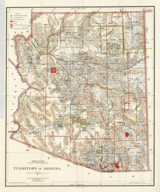
This beautifully colored and highly detailed map shows the extent of nine Indian reservations and at least four military reservations including Fort Apache. Indian reservations are outlined in green, military reservations are shown in solid red, and private claims, confirmed and unconfirmed, outlined in red. The Grand Canyon Reserve is shown. The brown hachured mountain areas and the blue waterways combine to provide great visual impact. Information includes watershed, mountains, railroads, wagon roads, private claims, unsurveyed townships, etc. The Hopi reservation is still called the "Moqui" reservation. This edition was revised and reconstructed by R.H. Morton. A very handsome and historical map.
References:
Condition: A+
Folding, as issued. A beautiful example with bright color and sharp impression with full margins.