Subject: Alaska
Period: 1788-1825 (published)
Publication:
Color: Hand Color
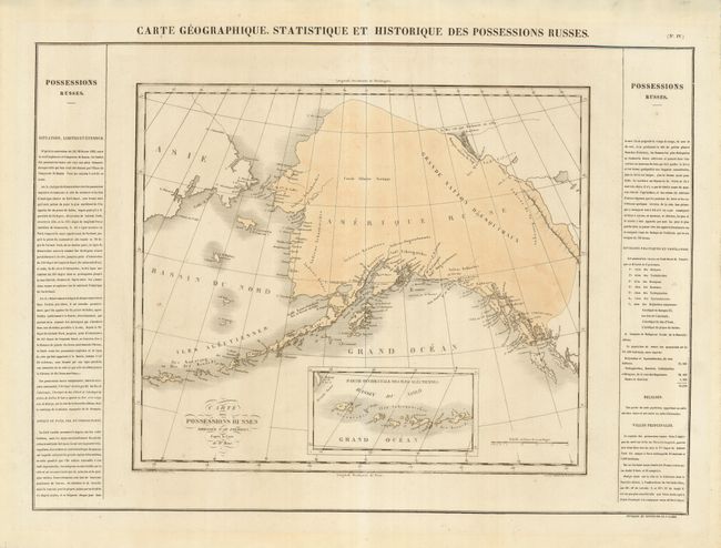
1) Carte Geographique, Statistique et Historique des Possessions Russes, from Jean Alexandre Buchon's Atlas Geographique, the French edition of Carey & Lea's American Atlas, published in 1825. Devoid of inland detail, the map concentrates on the coastal settlements and locates numerous Factorerie Russe. An inset continues the Aleutian Islands. The map is flanked with French text that includes a list of provinces and populations. The title within the map is Carte des Possessions Russes Dressee par Pierron, d'apres la Carte de Mr. Brue. The map is 17.5 x 14.8" and the overall size with the text and title is 25 x 18.5".
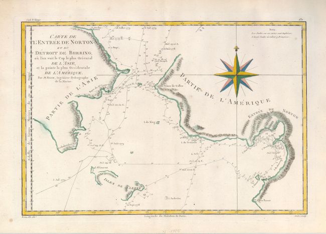
2) Carte de l'Entree de Norton et du Detroit de Bhering, ou l'on voit le cap le plus Oriental de l'Asie et la pointe la plus Occidentale de l'Amerique, by Rigobert Bonne, Atlas Encyclopedique, published in 1788. Great map of the Bering Strait showing the Chukotskiy and Seward peninsulas and parts of St. Lawrence Island (here Isles de Clerke). It plots the course of the voyages of 1778 and 1779, with soundings along the track. Cook had already died when the third expedition reached this area and the expedition was led by Captain Charles Clerke. Engraved by Andre and decorated with a large compass rose. (13.5 x 9.2")
References: Falk #1788-2 & 1825-1.
Condition: A+