Subject: Pacific Coast
Period: 1854 (dated)
Publication:
Color: Black & White
Size:
22.3 x 23 inches
56.6 x 58.4 cm
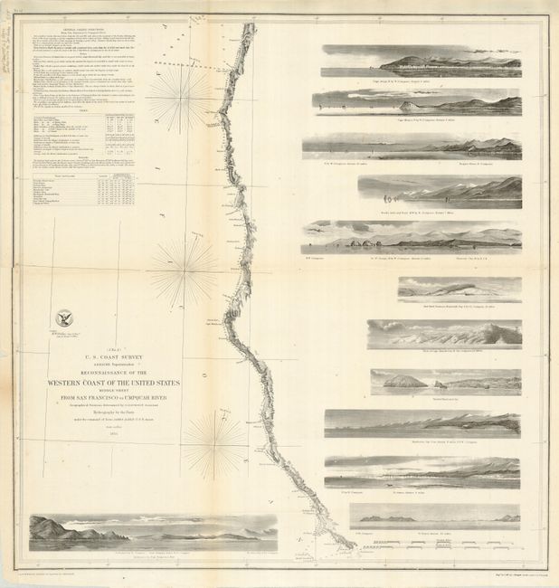
This terrific chart is from the first official scientific reconnaissance of the Pacific coast. It delineates the coast from the entrance of San Francisco Bay at Points Lobos and Bonita north to show Bodega Bay, Mendocino City, Shelter Cove, Cape Mendocino, Trinidad, Crescent City, Port Orford, Cape Aragos and to above the mouth of the Umpquah River. The most impressive features are the twelve views of entrances and promontories along this rugged coastline, including Mendocino City Cove, Point Blanco, and the Entrance to San Francisco Bay. Geographical positions were determined by G. Davidson Assistant. Map made under the command of Lieut. James Alden U.S.N.
References:
Condition: C+
Visually the map is fine, but there are numerous small wormholes, and the left border replaced in lower portion along binding trim.