Subject: Western United States
Period: 1881-1917 (dated)
Publication:
Color: Printed Color
Size:
4.3 x 6.5 inches
10.9 x 16.5 cm
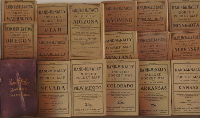
An almost complete collection of continental U.S. Trans-Mississippi West Indexed pocket maps by Rand, McNally & Co. All, except California, in original brown wrappers and dated between 1904 - 1917. The earlier California map is dated 1881 with original maroon cloth boards. These large maps vary in size, but each is in original covers and is complete with the original booklet the "Shipper's Guide…". The lot includes the following pocket maps.
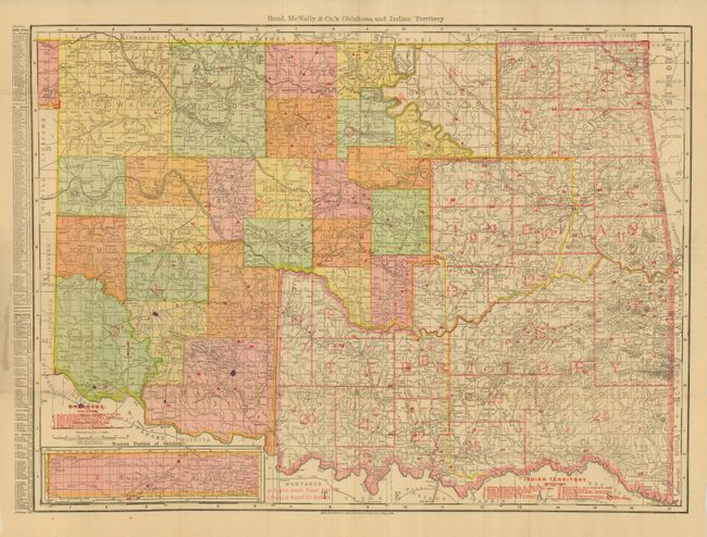
1. Indian and Oklahoma Territories. Cover split at spine.
2. Kansas. Fine.
3. Nebraska.
4. Minnesota. Includes Automobile Roads. Map and booklet loose from covers.
5. Arkansas. Includes Automobile Roads.
6. Texas. This huge map is loose from the covers.
7. Colorado. Fine 1915 edition that shows Electric rail lines.
8. Montana. Map is loose.
9. Wyoming.
10. New Mexico with Automobile Roads. Fine.
11. Arizona. This 1904 issue has split covers and some fold splits in map.
12. Nevada. Fine.
13. Idaho. Fine.
14. Utah. Includes Automobile roads.
15. Oregon. With 1900 Official Census.
16. Washington. Covers split.
17. Indexed Map of California. Covers stained, warped and spine partially missing. Map is fine.
This is a spectacular collection of these early pocket maps, which are very difficult to find in this condition.
References:
Condition: A
All maps present and all attached except for a few. Mostly very good with the occasional minor fold splits, some are fine. Other flaws noted in individual descriptions.