Subject: Central United States - Upper Mississippi River
Period: 1845 (published)
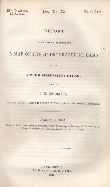
Publication: HR Doc. No. 52, 28th Cong., 2d Sess.
Color: Black & White
Size:
30 x 36 inches
76.2 x 91.4 cm
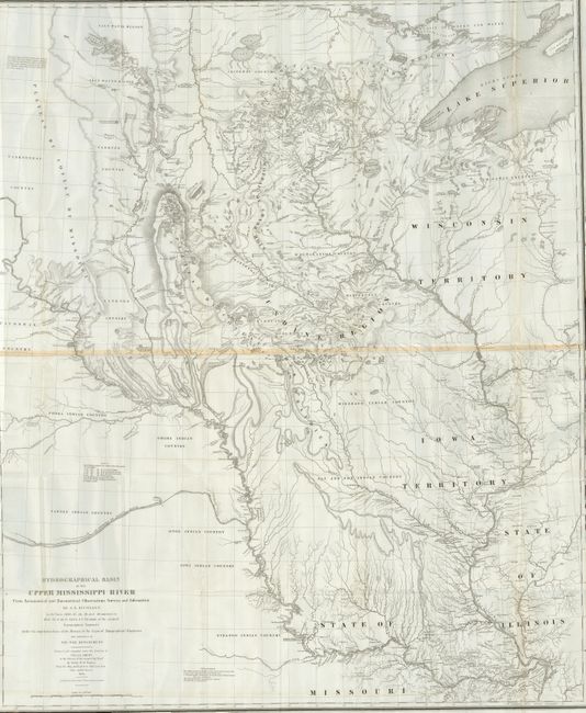
This extremely important map is the first accurate map of the interior region stretching from St. Louis north to the international boundary. The map was compiled by Lt. W. H. Emory (under the direction of Col. J. J. Albert) from the surveys of J. N. Nicollet, who was assisted by Lt. J. C. Fremont; thus, bringing together some of the most important names in the history of American mapping in the 19th century. Nicollet, already a noted French scientist and topographer, was chosen to lead this expedition during 1838 to 1840. The map reflects, for the first time, the use of the barometer to obtain elevations and the use of place names on maps based on a systematic analysis of Indian and French names. It is the first truly scientific topographical survey of the interior of North America. Contemporary cartographer, Lt. G. K. Warren, called it "one of the greatest contributions ever made to American geography." Lithographed by C. B. Graham and printed on two joined sheets.
Offered with the original "Report Intended to Illustrate a Map of the Hydrographical Basin of the Upper Mississippi River" (6" x 9") by Nicollet which describes his remarkable explorations on behalf of the Bureau of Topographical Engineers. A note explains Nicollet died while writing the introduction. Hardbound in modern cloth, 8vo, 170pp, folding map. Unusual to find the report and map together.
References: Claussen & Friis #390; Schwartz and Ehrenberg, p. 267-268, plt. 165.
Condition: A
The map is remarkable clean with full margins and a strong impression. With a hint of offsetting along bottom from the neat line and one small tear in lower margin just to neat line, otherwise a remarkably fine example. Contents near fine. Map is disbound from report.