Subject: Southeastern United States, Florida
Period: 1896 (dated)
Publication:
Color: Printed Color
Size:
17 x 37 inches
43.2 x 94 cm
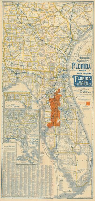
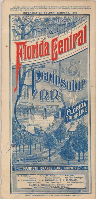
Great promotional railroad map's title continues "The Shortest and Quickest Route to all Points in Florida. Extending Directly through the Great Phosphate and Fruit Belt." The map is beautifully printed in blue, yellow and orange. The lands of the Florida Central & Peninsular Railroad Company are highlighted in orange and includes the towns of Lakeland, Dade City, St. Catherine, Wildwood, Summerfield, Silver Springs, Ocala, and Lochtoosa. The map extends north to include parts of Georgia and South Carolina to Columbia; an inset shows Western Florida. A large, separate representation is titled "South-eastern Portion of the United States showing Connections of Florida Central and Peninsula R.R." The verso contains 18 panels each topped with orange printed banner for the railroad. The text below describes the beauty, bounty and opportunity awaiting the "Tourist, Sportsman, Invalid, Settler and Prospector" traveling to Florida. Self folds, the lovely pictorial cover panel illustrates the Suwanee River, including music!. Printed by the Matthews-Northrup Company of Buffalo. A rare and desirable land promotional map that folds to a 4.2" x 9" brochure. A desirable RR land promotional brochure dated January, 1896.
References:
Condition: B+
Nice example with no flaws save a few fold intersection splits and a small tear in blank margin closed with archival tape.