Subject: Colonial Southeast
Period: 1778 (published)
Publication: Atlante Novissimo
Color: Hand Color
Size:
16.5 x 12.5 inches
41.9 x 31.8 cm
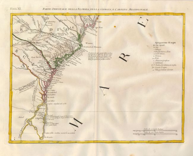
This detailed map covers the coastline from Wilmington and Cape Fear to St. Augustine and Cape Canaveral. The map depicts cities, town, Indian villages, forts and roads and is especially noteworthy for naming early counties in South Carolina. An Italian notation concerning the British attack on Charleston in 1776 and a key to the map appears in the Atlantic. At this time Florida was still British, having been acquired from Spain in 1763. The map is sheet XI from Zatta's Le Colonie Unite dell' America Settentrle, which is often referred to as the Italian edition of John Mitchell's map, on which it is based. Zatta's maps retain Mitchell's scale, but being smaller are more legible. Zatta also included updated legends (in Italian) with notations concerning the Revolutionary War. Each sheet stands on its own and has full borders.
References: Portinaro & Knirsch #153; Sellers and Van Ee #163.
Condition: A
Beautiful, early impression and fine outline color on hand laid paper with wide margins and two large watermarks. Fine less two insignificant spots in blank ocean and a couple water coloring flaws.