Subject: Colonial Southeast
Period: 1757 (dated)
Publication: L'Histoire Generale des Voyages
Color: Hand Color
Size:
11 x 7.3 inches
27.9 x 18.5 cm
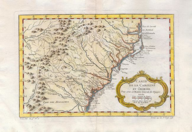
This delicately engraved map shows the colonies from Albemarle Sound to the Alatahama River. It probably owes its origin to the 1752 map of the region by Emanuel Bowen. Numerous English settlements along the coast and Indian villages are located throughout, including a number west of the Appalachian Mountains. There is more detail in the area west of the Blue Ridge than in many other maps of the period. The map shows a rudimentary course of the Tennessee River in the western section of the map. Decorative rococo-style title cartouche incorporates the distance scale.
References: Cummings (SE) #311; Sellers & van Ee #1384.
Condition: A
On hand laid paper with wide, original margins, fine impression and modern color. Some very light offsetting otherwise fine.