Subject: Colonial South
Period: 1778 (circa)
Publication: Atlante Novissimo
Color: Hand Color
Size:
16.5 x 12.5 inches
41.9 x 31.8 cm
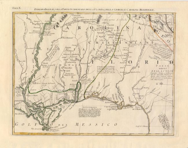
This map provides a great regional description of the Gulf Coast from New Orleans to Florida, and of the valley of the Mississippi River north to above the Arkansas River where Hernando de Soto was supposedly buried. The map also details Mobile Bay and the course of the Albama River and tributaries, as well as the region of Capo S. Biagio and the course of the Apalachicola River. In the north, the prominent trading route, Strada de Coll Welk, nearly reaches the Mississippi River and is marked with distances between important points. Another road is shown in Florida and several Indian trails are depicted. Numerous Indian tribes are located and there are notations concerning the quality of the land. The map is sheet X from Zatta's Le Colonie Unite dell' America Settentrle, which is often referred to as the Italian edition of John Mitchell's map, on which it is based. Zatta's maps retain Mitchell's scale, but being smaller are more legible. Zatta also included updated legends (in Italian) with notations concerning the Revolutionary War, such as Burgoyne's defeat at Saratoga.
References: Portinaro & Knirsch #152; Sellers and Van Ee #163.
Condition: A+
Nice impression and original outline color.