Catalog Archive
Auction 128, Lot 240

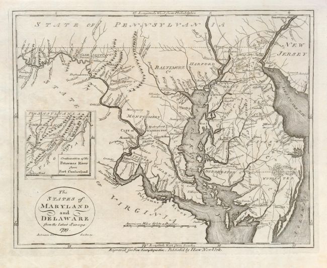
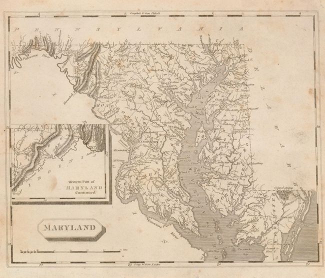
"[Lot of 2] The States of Maryland and Delaware from the Latest Surveys [and] Maryland",

Subject: Mid-Atlantic United States

Period: 1799-1805 (published)

Publication:

Color: Black & White

Size:
See Description
Download High Resolution Image
(or just click on image to launch the Zoom viewer)

1) J. Low, New York, 1799, from New Encyclopaedia, (9 x 7"). Strongly engraved by Scales, the map includes Delaware. The inset extends west, "Continuation of the Potomac River from Fort Cumberland." Title in circular cartouche, distance scale is in American Miles.

2) Arrowsmith & Lewis, 1805, (10 x 8"). This map presents an interesting contrast to the former showing markedly different courses to many rivers. States outside of Maryland are blank. The inset "Western Part of Maryland Continued" is on the same scale as the main map.

References:

Condition:

The former is fine (A+). The latter has some light scattered foxing principally at right (B+).

Estimate: $200 - $250

Sold for: $550

Closed on 5/20/2009

Archived