Subject: Colonial New England
Period: 1653-58 (published)
Publication: Nouvel Atlas
Color: Hand Color
Size:
19.7 x 15.2 inches
50 x 38.6 cm
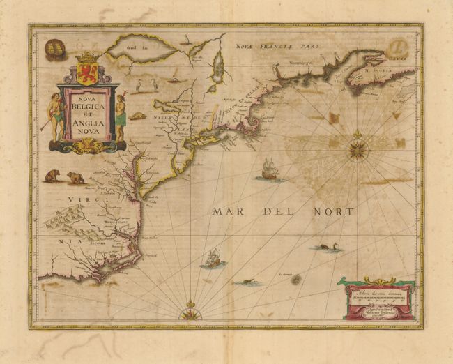
Jansson's influential map of the eastern coast of North America was first issued in 1636 with a less decorative title cartouche. It is derived from the less well known 1630 map of Johannes de Laet, which is generally regarded as the source map for New England and the Northeast. It includes several very early depictions of colonial settlement including Manhattan and the Dutch colony of New Amsterdam, the Nordt Rivier (Hudson) and Zuydt Rivier (Delaware), along with Massachusetts and the English colony at Plymouth. The map includes part of the Great Lakes labeled Grand Lac and Lac des Yroquois, an unnamed Lake Champlain, and a fictitious lake at the headwaters of the Delaware River. This is the second state with the shortened title, giving greater prominence to the Dutch colonies, a new cartouche, and with the addition of wildlife throughout the interior. It is beautifully adorned with cartouches, ships, sea monsters and compass roses. Latin text on verso.
References: Burden #247; McCorkle #636.2.
Condition: C+
Original color and dark impression on a full sheet with wide margins. The map has a little color offsetting and text and graphic offsetting from verso. Professional restoration on a vacuum table will easily convert this sound map into a fine example.