Subject: Continents
Period: 1741 (published)
Publication: Synopsis universae philologiae
Color: Hand Color
Size:
17.5 x 15.3 inches
44.5 x 38.9 cm
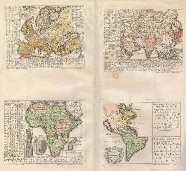
This fascinating set of thematic maps consists of four separate maps of the continents (each measuring approximately 7.7 x 6") on two joined sheets. Each map identifies the different countries and linguistic divisions, and each contains tables displaying their script, alphabets and spoken languages. Important in the history of thematic mapping, they are among the first to use color to distinguish areas and subjects on a theme. A Latin key in the lower right of the Africa map explains that colors show the areas populated by descendants of Ham, Japheth and Shem after the Flood. The American map depicts California as an island, and oddly includes what appears to be Persian and Indian alphabets in panels to the right. Drawn by Gottfried Hensel and engraved by S. Dorn.
References: McLaughlin #229; Robinson, pp 55-56, and 130-132.
Condition: B
Original color with a couple of small spots in the maps.