Subject: Eastern United States, Cities
Period: 1890 (circa)
Publication: Letts's Popular Atlas
Color: Printed Color
Size:
12.8 x 15 inches
32.5 x 38.1 cm
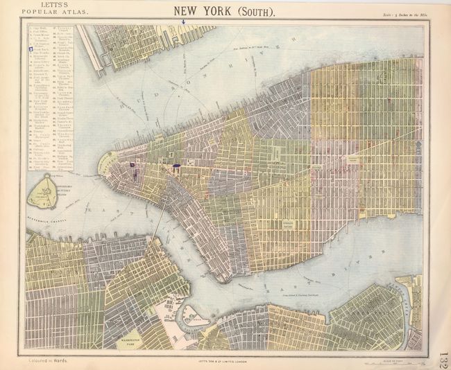
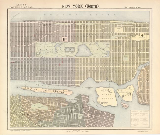
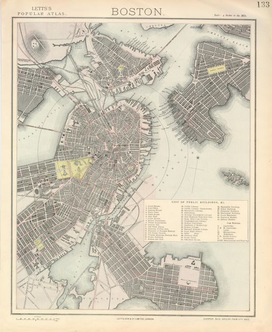
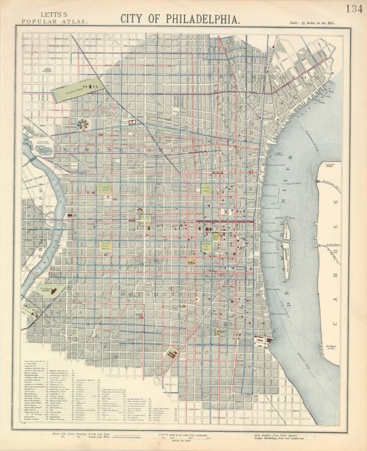
Four remarkably detailed city plans (3-4 inches/mile) naming all major streets, parks, gardens, squares, buildings. The matched pair of New York City maps locate many ferry routes and the yet unnamed Brooklyn Bridge. Central Park is shown, as are the elevated railroads and the map is colored by wards. Together they cover from Governors Island to 138th Street; the two maps meet at 42nd Street. Legend keys 70 buildings of note. The map of Boston extends further than typically seen to include Bird Island, Chelsea Reach, the outlet of the Mystic River, and all of South Boston. Legend locates 41 buildings and places. Eight 'car' routes through the city are also detailed. In Philadelphia, 96 prominent buildings are identified, including colleges and military sites. Camden is across the Delaware River and West Philadelphia beyond the Schuylkill. Colored lines show streetcar routes. A great set of matching city plans.
References:
Condition: A
All fine less New York South which has a few marks with blue ink.