Subject: United States
Period: 1872 (dated)
Publication:
Color: Hand Color
Size:
24.5 x 16.3 inches
62.2 x 41.4 cm
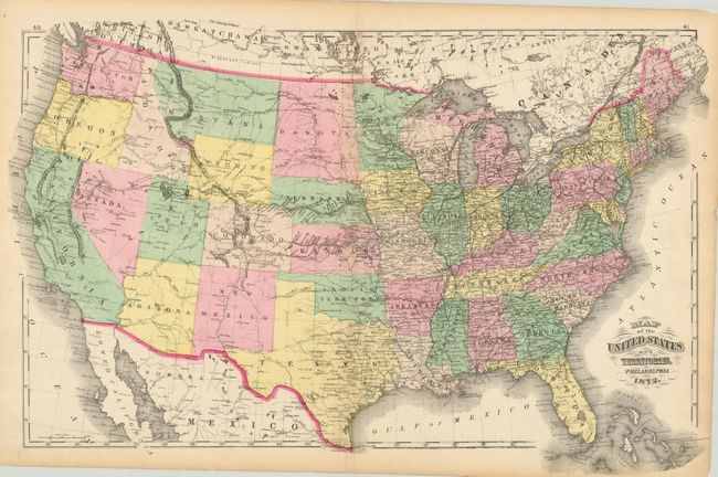
This large map of the United States shows the western territorial boundaries toward the end of their evolution. The configuration of Wyoming is unique as it includes the small tip extending to the west, but here it is called "Part of Dakota" obviously in a hasty hand following the creation of Wyoming. The large Dakota Territory will not split into north and south for another 17 years. New and planned railroads penetrate into the West. A handsome map with each state and territory individually hand colored. Populations for 1860 and 1870 on verso.
References:
Condition: B+
The map image is near fine, but with a clean centerfold split at top and bottom closed on verso with wide archival tape. Toning along edges and a few small chips or short tears.