Subject: United States
Period: 1852-71 (published)
Publication:
Color: Hand Color
This informative lot of double page maps from Mitchell's School Geography books illustrates the evolving western geography between 1852 and 1871.
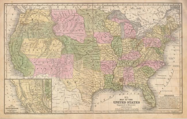
1) The first, published in 1852, features terrific western territorial borders including the important territorial acquisitions of the Mexican-American War, pre-Gadsden Purchase. The inset map "No. 6 Map of the Gold Region of California" delineates the Gold Regions, naming Sutter's Buttes, Sacramento City, and all of the important creeks of the gold region feeding into the Sacramento and Feather Rivers. The territories of Oregon and Washington extend to the Continental Divide. Minnesota Territory includes part of the Dakotas and the huge Missouri Territory rests between the Continental Divide and Minnesota, with Indian Territory bordering on the south. Indian Territory is in its largest configuration, stretching from Texas to Missouri Territory along the North Fork of the Platte River and extends westward all the way to South Pass and Utah Territory. Utah is also in its largest shape, filling the region from California to Indian Territory along the Continental Divide. Dated 1852, original hand coloring. (16.7" x 10.5"). Student pencil notes on verso, some staining or foxing at right and short tear at bottom just enters map. (B)
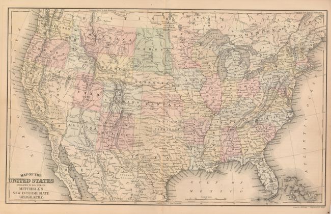
2) This circa 1866 map details the maturing western landscape. The four corner territories and Nevada now have their final borders. The map shows the Wyoming region as "Attached to Dakota". The Gold Region is clearly shown near Denver in Colorado, and Silver Mines exist along the Gila River in Arizona. The lower portion of Nevada is "Unexplored." (17.3 x 10.5"). (A)
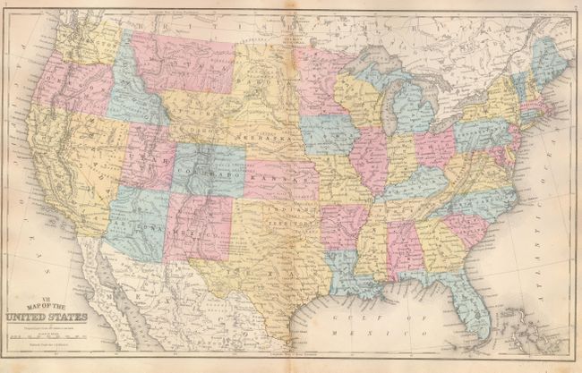
3) This 1871 map nearly completes the boundaries in the western half of the United States. Wyoming has recently formed but this map continues the confused extension in the northwest with hand coloring. The Gold Region and the Silver Regions are shown in Colorado and Arizona. The lower portion of Nevada is still considered "Unexplored." Drawn by J.H. Young and engraved by E. Yeager. (17.3 x 10.5"). (A)
References:
Condition:
See individual descriptions.