Subject: Arctic, Canada and Alaska
Period: 1769 (dated)
Publication: Diderot's Encyclopedia (Supplement)
Color: Black & White
Size:
19 x 11.5 inches
48.3 x 29.2 cm
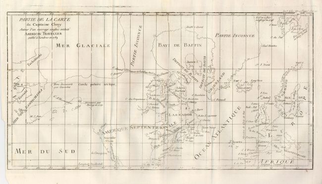
While this fascinating map covers the Arctic from Asia through Europe, the focus of the map is on the North American Arctic region. The most important feature of the map is the early depiction of what is present-day Alaska, patterned after Muller's epic map of 1750 that was the first to show the Russian discoveries, also noted here. The peninsula is shown as an indistinct dashed line that extends out to M. S. Jean. Early explorations are noted: "Terre decoverte par Gwosdew (Gwosden)" and Decouvert par Bering en 1741." A very interesting Northwest Passage is shown from Repulse Bay in the north part of Hudson Bay into the Arctic Ocean at Cape Fowler. The River of the West enters at about 45° with an uncertain course that is roughly aligned with the F. York river in the southwest of Hudson Bay, another allusion to the Northwest Passage.
References: Wagner #637-10; Pedley #460.
Condition: A
Fine, clean example with full margins and dark, early impression. Large watermark. Binding trim at lower left includes the tip of the corner, as issued. One small spot near lower right border, otherwise a fine example.