Subject: Eastern United States & Canada
Period: 1806 (dated)
Publication:
Color: Hand Color
Size:
29.5 x 19.5 inches
74.9 x 49.5 cm
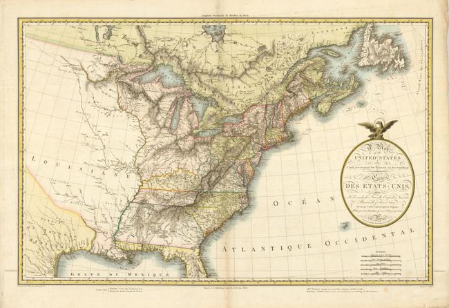
This very uncommon map was drawn by Pierre Lapie, a captain in the Imperial Corps of Engineers, engraved by Pierre Antoine Tardieu, and published by J.A. Dezauche; thus bringing together three of the most prominent French cartographers of the early nineteenth century. The finely engraved map is largely based on the work of Aaron Arrowsmith and shows the United States during an important period in its development just after the acquisition of the Louisiana Territory. Georgia Territory takes in regions of present-day Alabama and Mississippi, most of which is noted as the home of the Creek and Chactaw Indians. The large map is a great illustration of just how little was known about western frontier, which is largely blank except for numerous Indian nations. The title, in both English and French, is contained in a simple oval cartouche surmounted by an eagle.
References:
Condition: A
Sharp impression and original color. Faintly toned on the centerfold with a couple minor extraneous folds.