Subject: Canada & Central United States
Period: 1790 (circa)
Publication: Allgemeiner Grosser Atlas
Color: Hand Color
Size:
23 x 19.8 inches
58.4 x 50.3 cm
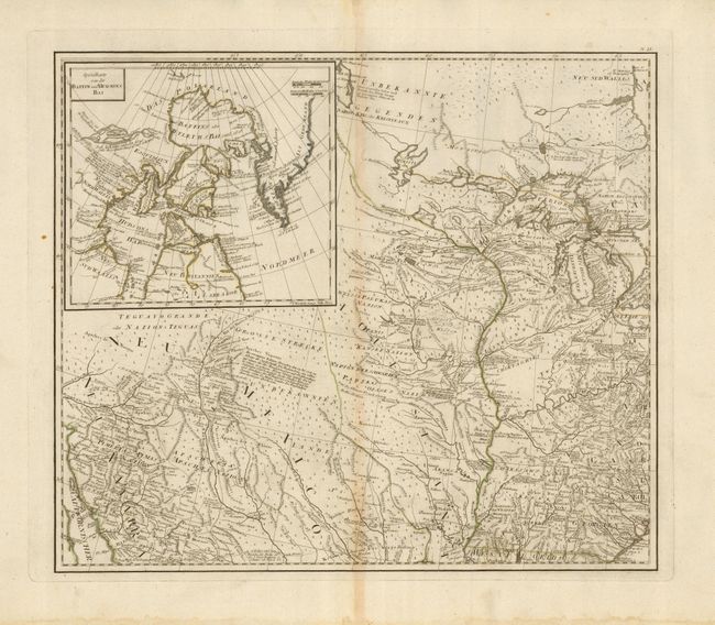
This is the northwest sheet from the very uncommon Austrian-produced map that covers from the Great Lakes nearly to the Gulf of Mexico and from the Appalachian Mountains to Sonora, Mexico. It was based on the surveys of Major Samuel Holland and Governor Thomas Pownall. This sheet includes the large area between the Gulf of Baja (with a small portion of California) up to the lakes Superior, Michigan, Huron and Erie. It is filled throughout with remarkable detail of Indian lands, exploration routes, watershed, spurious topography, settlements, forts, and much more. The large inset at upper left "Specialkarte von de Baffin un Hudson's Bay" includes the See de Fonte depicting the fictitious Northwest Passage of Admiral de Fonte (1640).
References:
Condition: B+
Spectacular impression on thick paper with huge margins. A small line of water stain along lower edge and very light centerfold toning, otherwise a fine example.