Subject: Colonial United States and Canada
Period: 1763 (dated)
Publication: A Voyage to North-America
Color: Hand Color
Size:
15 x 11 inches
38.1 x 27.9 cm
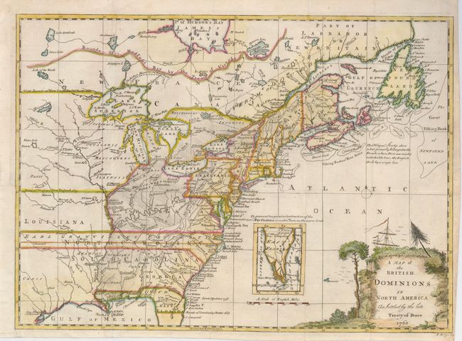
This is an interesting and detailed map of eastern North America as it was divided at the end of the French and Indian War. The map appeared in a scarce Irish edition of Pierre François Xavier de Charlevoix's important description of New France and Louisiana. The map presents an Anglo-centric view of North America with the English colonial possessions in the Carolinas and Virginia extending across the Mississippi River. The most interesting feature of the map is the region engraved "by Oblique Strokes" to show the areas which were formerly controlled by the French prior to the conclusion of the war. The map also notes a huge territorial claim by Earl Granville, extending from Albermarle Sound to well west of the Mississippi River. A large inset continues the delineation of the Florida peninsula. This is the second state of the map, with the note on the French Encroachments re-engraved, and the list of French forts replaced by the inset of Florida.
References:
Condition: B+
Issued folding, now flattened. The binding trim has been replaced at lower left and a short binding trim along the map border has been neatly repaired.