Catalog Archive
Auction 128, Lot 157

"Geographical, Statistical, and Historical Map of Upper and Lower Canada, and the other British Possessions in North America", Carey & Lea
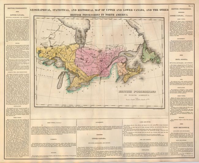
Subject: Canada

Period: 1822 (published)

Publication: A Complete Historical, Chronological, and Geographical American Atlas

Color: Hand Color

Size:
20.5 x 16.7 inches
52.1 x 42.4 cm
Download High Resolution Image
(or just click on image to launch the Zoom viewer)

On a full sheet (22" x 17.5") the map "British Possessions in North America" (14 x 9.8") includes the Great Lakes and extends to the west including Lake of the Woods and east to Newfoundland. Part of Hudson Bay is shown. This handsome, well engraved and colored sheet has text on three sides explaining geography, history, government structure, chief towns and more. In Upper Canada are Gloucester, Osnabugh, Henley, Michpecoten Cat Lake, and Red Land Houses of the Ojibwa.

References:

Condition: B+

Fine color and impression with original margins. A very few light foxing spots or offsetting. Tissue backing along centerfold on verso.

Estimate: $120 - $160

Sold for: $80

Closed on 5/20/2009

Archived