Subject: Colonial North America
Period: 1777 (dated)
Publication:
Color: Hand Color
Size:
18.8 x 22.8 inches
47.8 x 57.9 cm
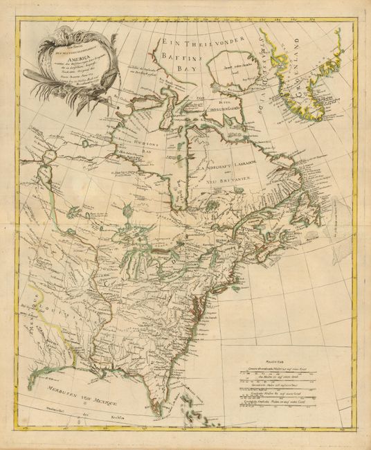
This finely engraved Revolutionary War map is a close copy of Bonne's Theatre de la Guerre en Amerique…, published by Muller. It details the region embroiled in the conflict and extends from eastern Canada and Greenland to Tobago in the West Indies. In Canada, it includes an interesting depiction of a passage from Hudson Bay westward though a network of rivers and lakes alluding to a possible Northwest Passage to the Pacific. French Louisiana is sandwiched between Mexique and the British Colonies with their western boundary on the Mississippi River. Good detail of Indian villages and the numerous forts that played a role in the War of Independence. The Bonne map began life in 1771 with the title "Partie de l'Amerique Septentrionale, qui comprend le Canada, la Louisiane, le Labrador, le Groenland, la Nouvelle Angleterre, la Floride &c." It went through several editions to 1783, with title changes to reflect the changing political climate. This is the uncommon German edition of 1777.
References: McCorkle #777.5.
Condition: B+
A couple light spots otherwise very good with fine original outline color, delicate impression, full margins.