Subject: Colonial North America
Period: 1720 (circa)
Publication:
Color: Hand Color
Size:
22.5 x 18.5 inches
57.2 x 47 cm
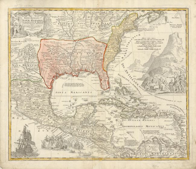
A superb map covering the region from the Great Lakes and Nova Scotia through Central America, the Caribbean and Venezuela, and from New Mexico (naming Taos and Santa Fe) to the eastern seaboard. The map is based largely on Delisle's map of 1703 (Carte du Mexique et de la Floride). The British colonies are shown confined east of the Appalachians. The map itself is filled with settlement place names, Indian tribes and villages. Sea routes from Vera Cruz and Cartagena to Havana and Spain are outlined. It is richly embellished with a fine title cartouche depicting two native figures and symbols of America's natural resources. In the Atlantic, there is a large scene of extensive gold mining operations with Indians bringing their treasures to fill the European's chest. Off the Pacific coast of Mexico is yet another opulent engraving of a raging sea battle.
References: Van Ermen p.42; cf Cumming (SE) #137; Manasek #72; Martin & Martin plt.17.
Condition: A
Fine impression, original color on thick hand laid paper with original margins. Some creasing at centerfold, thinness along centerfold only visible when held to the light, and an old owner's or business stamp on verso with no show through to map.