Subject: North America
Period: 1825-27 (published)
Publication: Atlas Universel
Color: Black & White
Size:
24 x 19 inches
61 x 48.3 cm
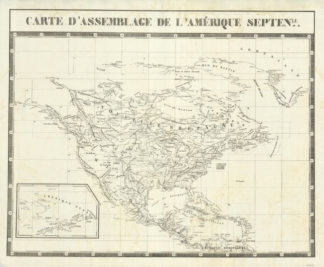
This is the index map of North America to Vandermaelen's monumental Atlas Universel. Vandermaelen's maps of the American West are a landmark in the history of cartography and this key sheet presents the major topographical features along with the locations of major Indian tribes. Alaska is shown in an inset. The maps in this atlas were all presented on a uniform scale (1: 1,641,836), and each map covered an area of approximately 20 degrees longitude (from Paris) and 6 degrees of latitude. The maps were meant to be joined together to form a huge globe measuring 7.775 meters in diameter. It was also considered to be the first lithographic atlas ever published. Only one edition of the atlas was published in 1825-27, and the subscription list shows that just 810 copies were sold; thus the maps are very scarce on the market today.
References: Phillips (A) #749.
Condition: B+
Faint offsetting and some tears in the blank margins.