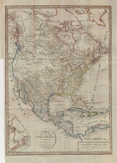
Subject: North America
Period: 1818 (dated)
Publication: Neueste Lander und Boltersunde…
Color: Hand Color
Size:
12 x 16 inches
30.5 x 40.6 cm
This most uncommon Prague-produced map shows North America and Central America in fine detail. Along the east coast all of the states are delineated and named, but in the west the geography is imaginative with many spurious features. In present day eastern Washington, Idaho and Montana is the huge inland sea labeled the Alsimbolen See. Rivers flow in and out of the Great Basin area and there is no sign of the Rocky Mountains. The coastal range, however, takes a wild turn to the east near Cape Mendocino, running across the Great Basin and down to the Southwest where the mountains end in the lands of the Apaches and Navaho. Towns, villages, forts and Indian lands fill the map, and a huge amount of watershed detail is given. Circular cartouche with flourishes to title.
References:
Condition: A
Folding, as issued, on thick hand laid paper with watermark. Very nice impression and coloring with a light smudge of printer's ink across the distance scale from the printer's incomplete wiping of the plate.