Catalog Archive
Auction 128, Lot 118

"America Septentrionalis Studio Guilielmi de l'Isle…", Weigel, Christopher

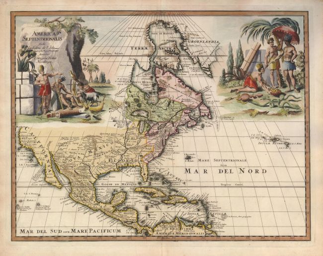
Subject: North America

Period: 1718 (circa)

Publication:

Color: Hand Color

Size:
16.3 x 12.5 inches
41.4 x 31.8 cm
Download High Resolution Image
(or just click on image to launch the Zoom viewer)

This scarce decorative map is based on Delisle's foundation map of North America. It shows a peninsular California with C. Mendocin as the farthest northern point on the west coast. The English settlements are confined east of the Alleghenies. The Mississippi River valley is well developed with recent French settlements located. The interior is filled with the names of various Indian nations. The map is exquisitely adorned with two large vignette-style cartouches depicting Native Americans and exotic animals. This is an early state; later editions of this map were revised to include an inset map of Halifax.

References:

Condition: A+

Estimate: $1,300 - $1,500

Sold for: $1,100

Closed on 5/20/2009

Archived