Subject: Western Hemisphere
Period: 1806 (dated)
Publication:
Color: Black & White
Size:
8.3 x 7 inches
21.1 x 17.8 cm
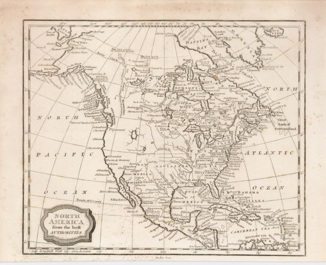
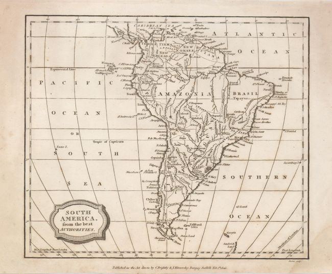
Matched pair of maps of the continents with fine engraving style. Both have ruled block-style title cartouches and each measure as given.
1. Alaska is fairly well formed, but still an early configuration with the label "Alaska" on the Aleutian Peninsula. Recent explorations are noted in the Arctic. The Stoney Mountains are noted in Canada, but do not extend into what is now the western U.S., which is largely blank except for two large unnamed lakes in the intermountain region. "Texas" is named as a town on the Rio Colorado which runs into the Gulf of Mexico east of the Rio Grande, here Rio Bravo. Dark impression and full margins. A little fly speckling at lower left, otherwise very good (B+).
2. South America is dominated by extensive river systems and mountain ranges. Lake Parime is in today's Venezuela, but does not mention Dorado. Light stain at lower right corner, and a few light spots in upper left corner (B+).
References:
Condition:
See individual descriptions.