Subject: Western Hemisphere
Period: 1700 (circa)
Publication:
Color: Hand Color
Size:
5.2 x 5.8 inches
13.2 x 14.7 cm
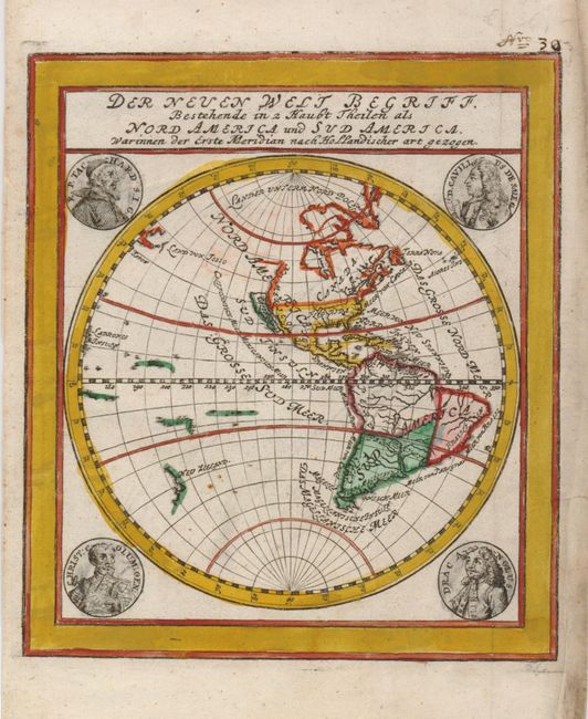
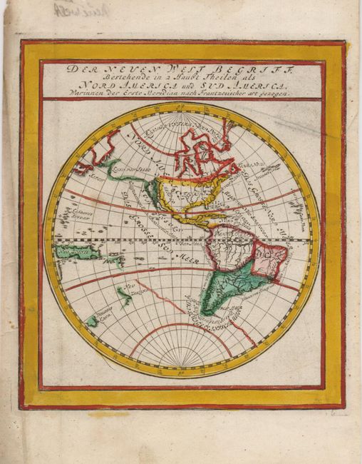
These two maps are a great comparison of the development of New World cartography during the latter part of the seventeenth century. Both maps depict North and South America in identical projections and show California as an island; but that is where the similarity ends.
The map with the medallion portraits of famous explorers is presented from the Dutch perspective. It shows the northwest coastline of North America extending well north, and bending northeast of California. Hudson Bay is delineated but there is no waterway to the west of that bay, and there is a single, open-ended lake in the Great Lakes region. There are a few small islands and the western coastline of New Zealand in the Pacific.
The other map is presented from the French standpoint. In North America, the Great Lakes are nearly fully formed and there is a large bay to the west of Hudson Bay. A huge landmass (Land von Jesso) stretches between North America and Asia. New Guinea is completely shown along with the western coastline of New Zealand and part of Tasmania (Diemens Land), which are located further east than on the Dutch map that omits Tasmania. In South America the major river systems are quite a bit different with the Amazon more correctly shown here. A remnant of the legendary southern continent is still evident on this map.
References:
Condition: B+
Mild soil, mostly in the margins with some archival tape on the versos, evidently reinforcing the margins. Worm tracks in edge of top margin.