Subject: Western Hemisphere
Period: 1675 (circa)
Publication:
Color: Hand Color
Size:
22.8 x 19.2 inches
57.9 x 48.8 cm
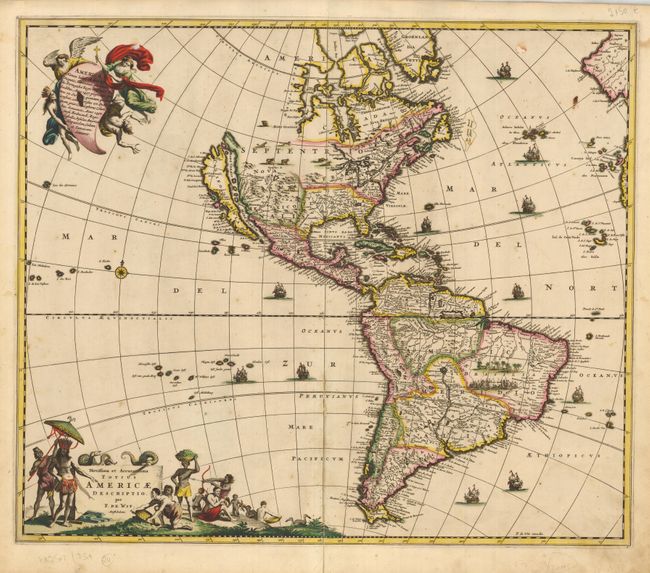
This is a close derivative of Nicolas Visscher's influential map of the Americas. Here, however, the island of California and the Great Lakes are shown on the Sanson model. In the Southwest, the Rio del Norto flows from a large interior lake and empties into the sea between the mainland and California. In South America, Parime Lacus is prominent and a battle scene and village appear in the Brazilian interior. In the South Pacific a large Quiri Regio coastline is located below the Salomon Islands. The map is embellished with two large cartouches that were also copied from Visscher. The top cartouche depicts angels struggling with a devil for the soul of a Native American. The pictorial title cartouche contains scenes of gold panning, hunting and a native chief standing beneath an umbrella. The only change De Wit made is moving the standing chief from right, as in Visscher's composition, to the left. This map is the rare first state with Madera, longitudinal lines to the nearest 10s, and the ships in the oceans.
References: Burden #465; McLaughlin #49-1; Tooley p. 120 #31; Wheat [TMW] #52.
Condition: B+
Very fine impression and color (original) with full margins. A bit of the lower centerfold is split, small paper abrasion in upper left.