Subject: North America
Period: 1836 (dated)
Publication:
Color: Hand Color
Size:
12.8 x 10 inches
32.5 x 25.4 cm
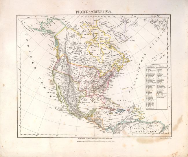
This attractive map of North America and the West Indies focuses mainly on topography, with outline color delineating nations, states and colonial possessions. The northern border with Canada extends the claims of the United States beyond the 50° latitude. Texas and the entire Southwest are still a part of Mexico. A key at right enumerates the states and territories in the United States and Mexico. In the U.S. are 25 states, the two territories of Arkansas and Florida, and six Indian districts; Ozark, Osage, Sioux, Huron, Mandan and Oregon.
References:
Condition: B
There is some light foxing and stains, and a few paper edge tears not near the map.