Subject: Cartographic Reference
Period: 1987-2001
Publication:
Color:
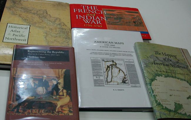
1) Representing the Republic Mapping the United States, 1600-1900, John Rennie Short, London, 2001. (6.5 x 9.8") Dust cover with protective sleeve. (A+)
2) The French and Indian War 1754-1763 The Imperial Struggle for North America, Seymour I. Schwartz, New York, 1994. (10.3 x 7.3") Dust Cover. (A+)
3) American Maps 1795-1895 A Guide to Values, K.A. Sheets, Ann Arbor, 1994. (8.8 x 11.3") Dust Cover with protective sleeve. (A+)
4) The Mapping of the American Southwest, Dennis Reinhartz and Charles C. Colley, College Station, 1987. (7.5 x 10.3")
5) Historical Atlas of the Pacific Northwest Maps of Exploration and Discovery, Derek Hayes, Seattle, 2000. (9.8 x 13") Dust cover. Top edge of dust cover a little rolled, still fine. (A+)
References:
Condition:
See individual descriptions above.